Detailed Climate Information for Mexico: Regional Weather Patterns and Data
Mexico, located in North America, is a country known for its diverse climate and stunning landscapes.
Mexico experiences a range of climates due to its diverse topography. In the coastal regions, the climate is typically tropical, with high humidity and rainfall. In the central highlands, the climate is more temperate, with cooler temperatures. Northern Mexico tends to have a desert climate with hot, arid conditions. The Yucatan Peninsula has a hot and humid climate, while the mountainous regions can experience colder temperatures and even snow during winter.
Best Travel Time Guide for Mexico: Ideal Seasons and Weather Insights
The best time to travel to Mexico depends on the region you plan to visit. For coastal areas and the Yucatan Peninsula, the ideal time is during the dry season from November to April when temperatures are more comfortable. Inland regions and the central highlands are best visited during the cooler months from November to February. Northern Mexico is best visited during the spring and fall when temperatures are milder. The mountainous regions are great to visit during the summer months when temperatures are cooler.
Detailed Climate in the Regions of Mexico
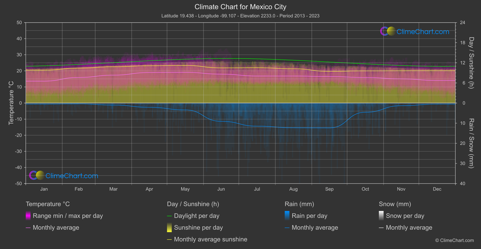
Mexico City
Region South
The monthly mean temperature reaches its highest point in May, at 19.
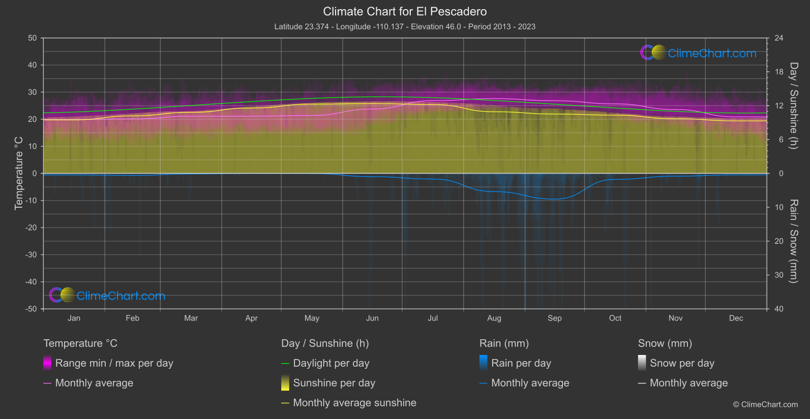
El Pescadero
The coolest monthly mean is recorded in January, at 19.
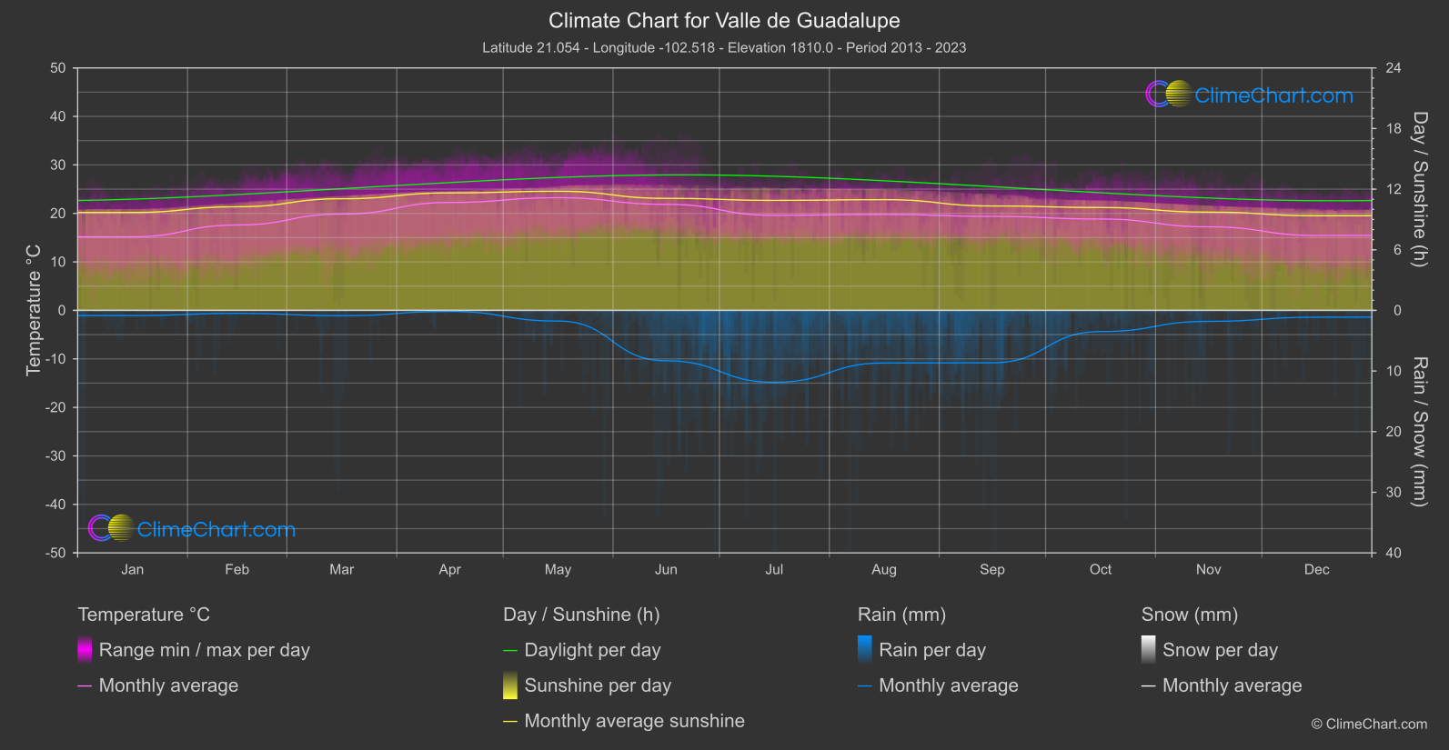
Valle de Guadalupe
Valle de Guadalupe in Mexico enjoys a Mediterranean climate with warm, dry summers and mild, wet winters.
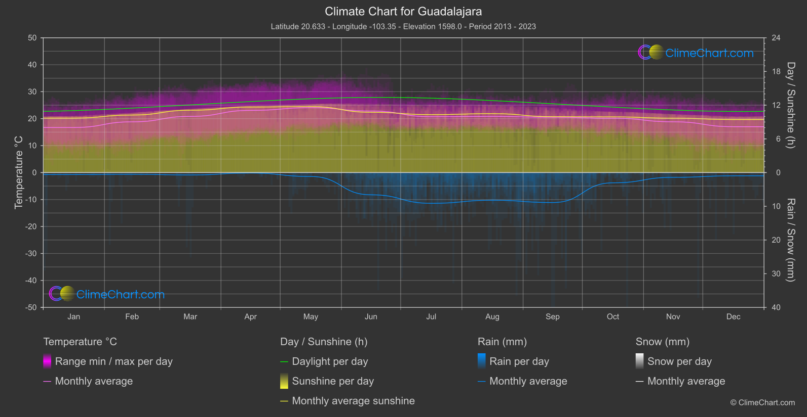
Guadalajara
Region Central
Monthly mean temperatures are coolest in January, at 16.
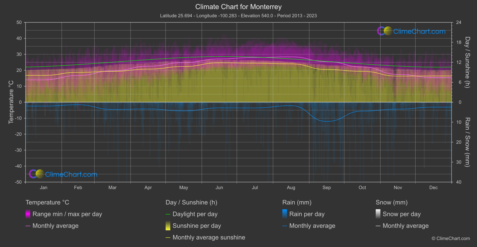
Monterrey
Region Central
The coolest monthly mean is 14.
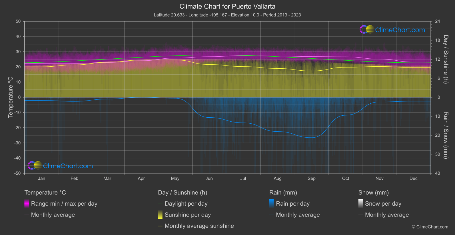
Puerto Vallarta
Region Central
Monthly mean temperatures are coolest in January / February, at 22.
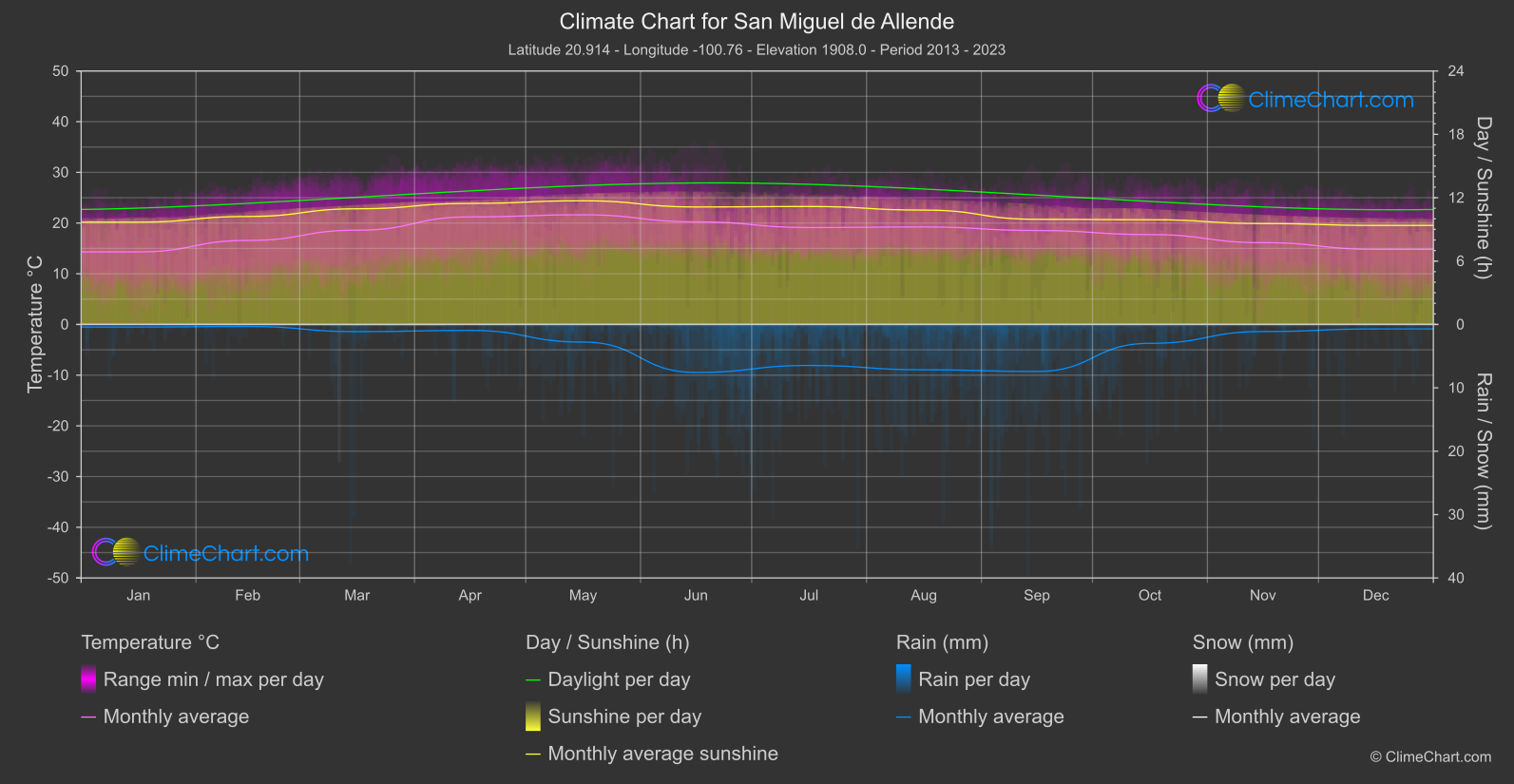
San Miguel de Allende
Region Central
Monthly mean temperatures range from a low of 14.
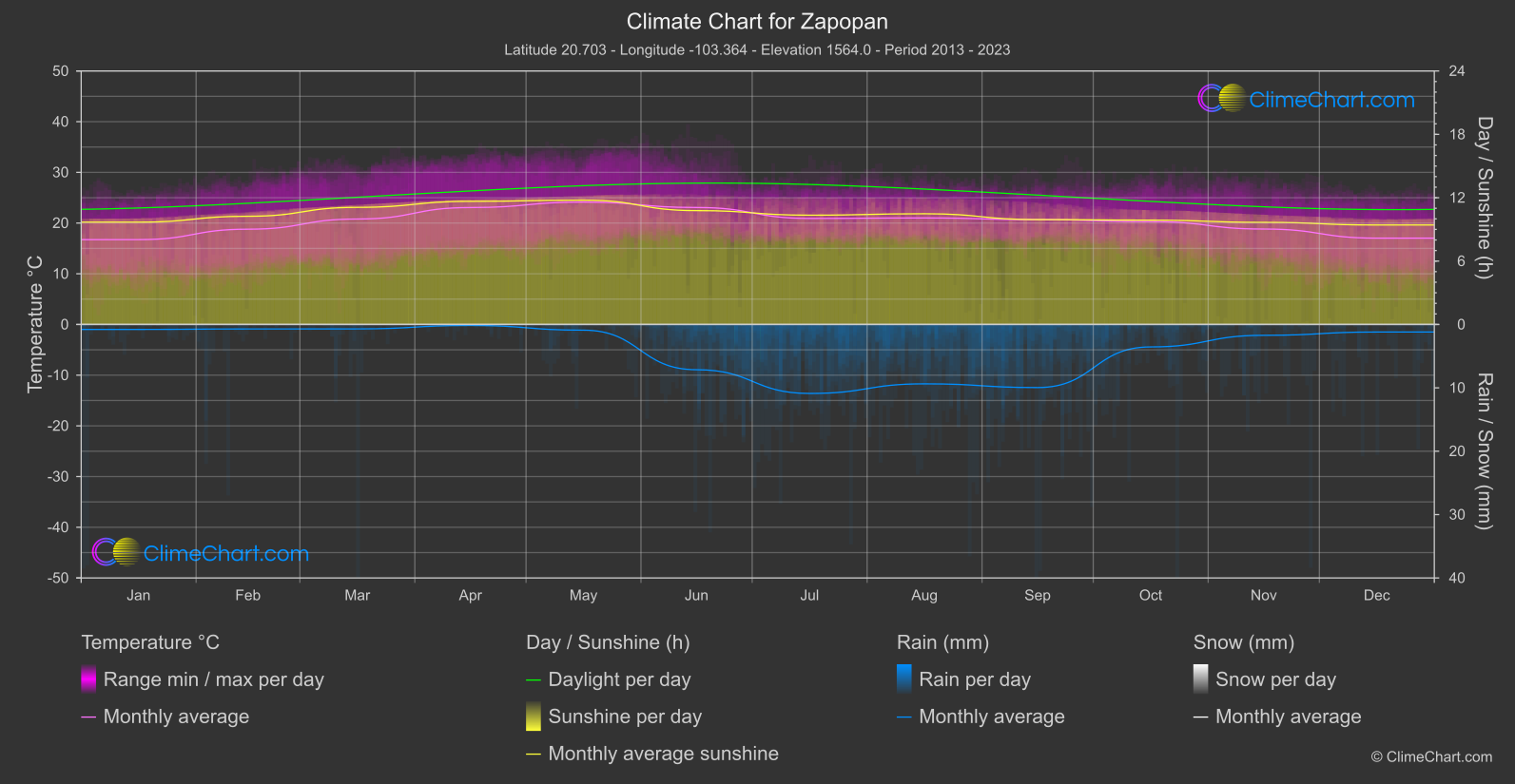
Zapopan
Region Central
The monthly mean temperature is lowest in January at 16.
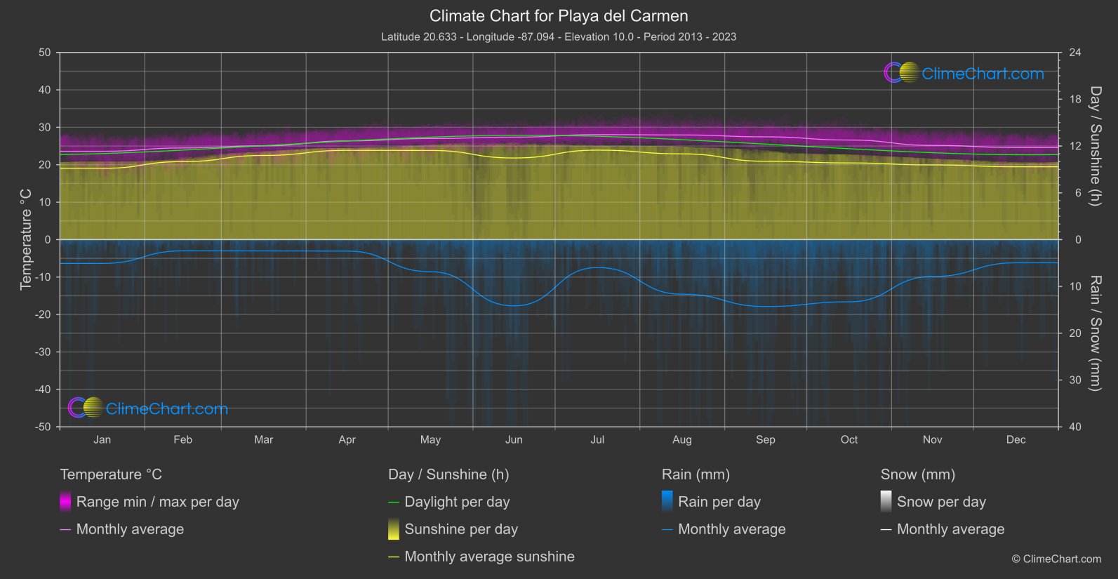
Playa del Carmen
Region East
The coolest monthly mean is in January, at 23.
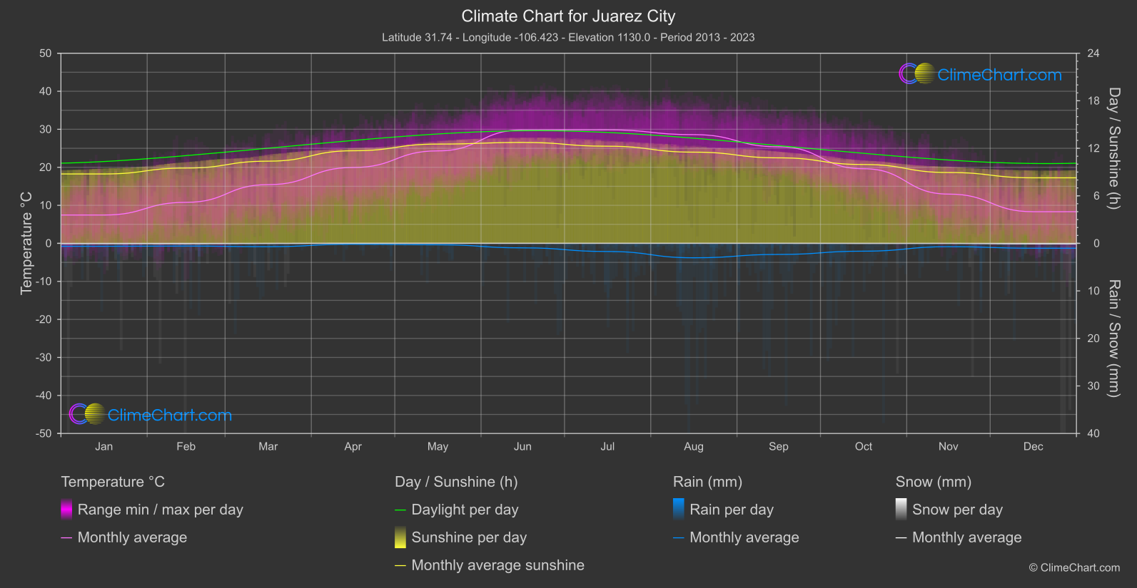
Juarez City
Region North
Monthly mean temperatures are coolest in January, at 7.
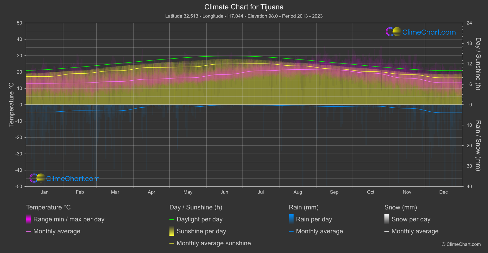
Tijuana
Region North-West
Monthly mean temperatures are coolest in January, at 13.
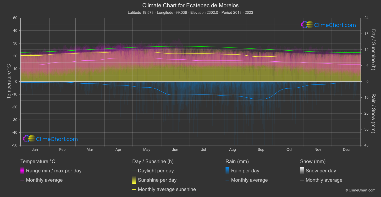
Ecatepec de Morelos
Region South
The coolest monthly mean is 13.
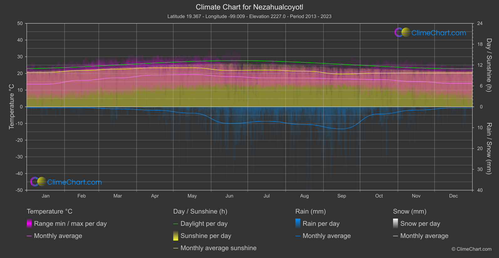
Nezahualcoyotl
Region South
The monthly mean temperature is coolest in January, at 13.
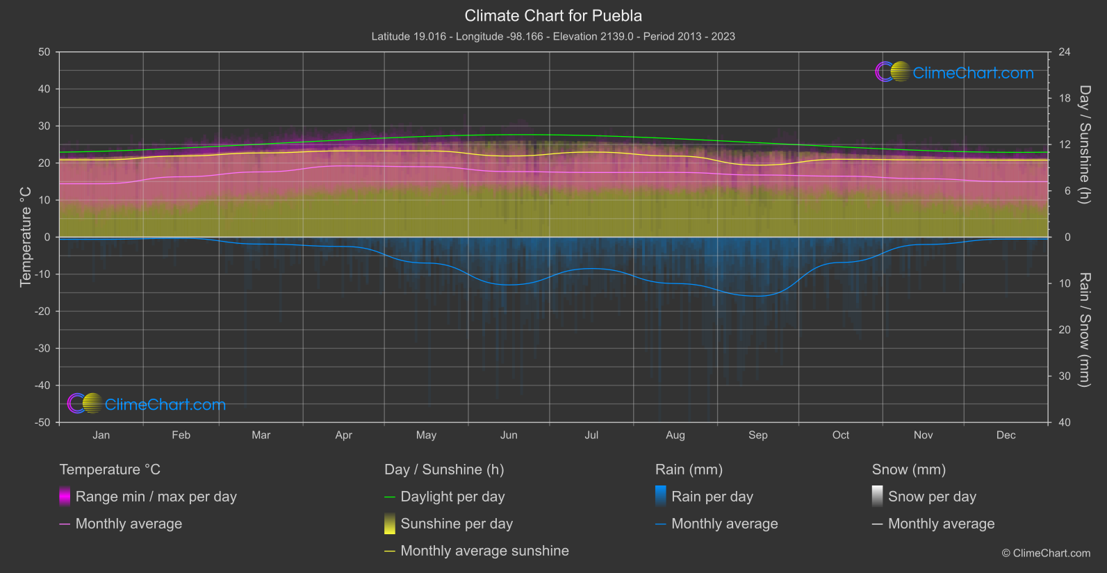
Puebla
Region South
The monthly mean temperature peaks in April at 19.
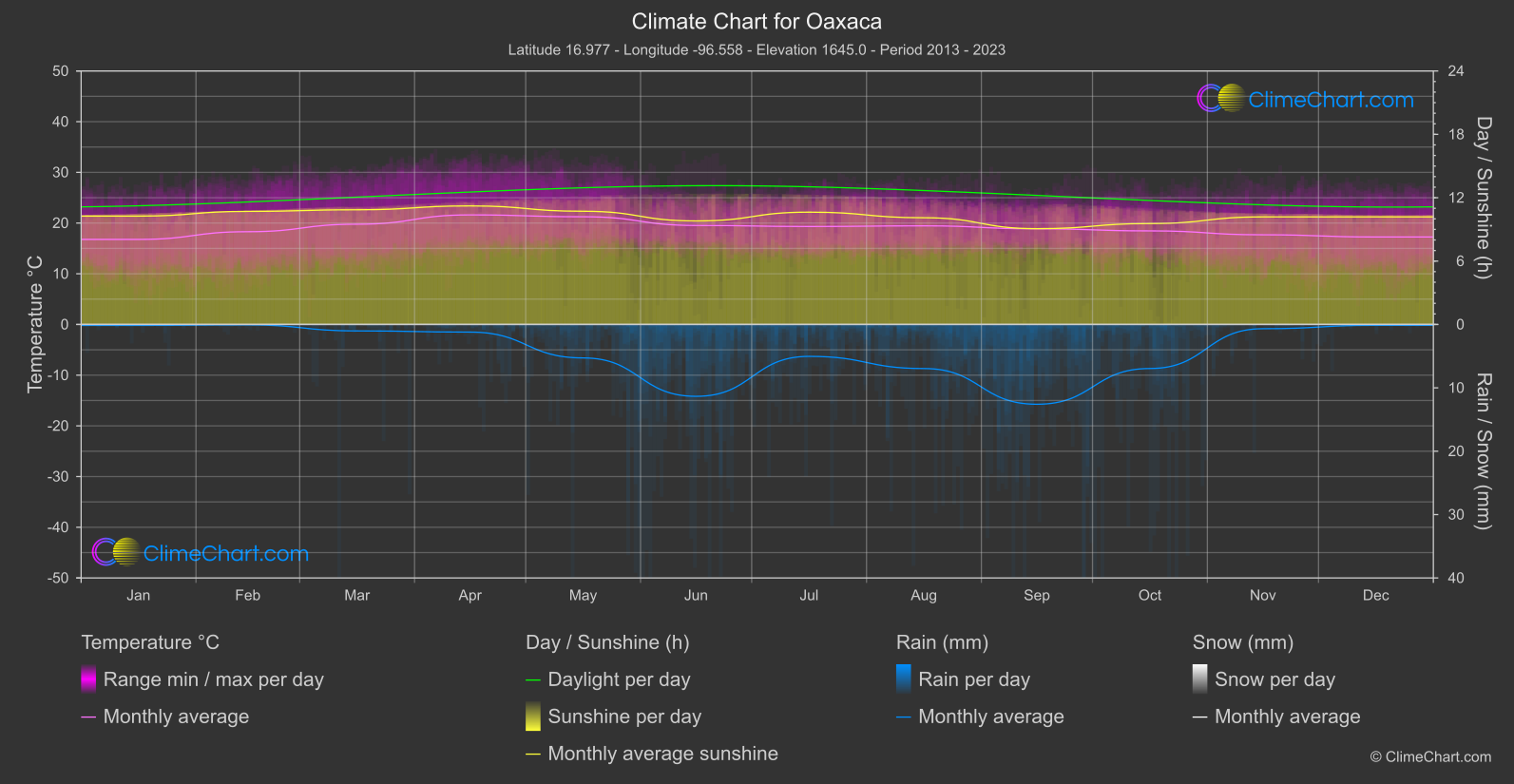
Oaxaca
Region South-East
The coolest monthly mean is 16.
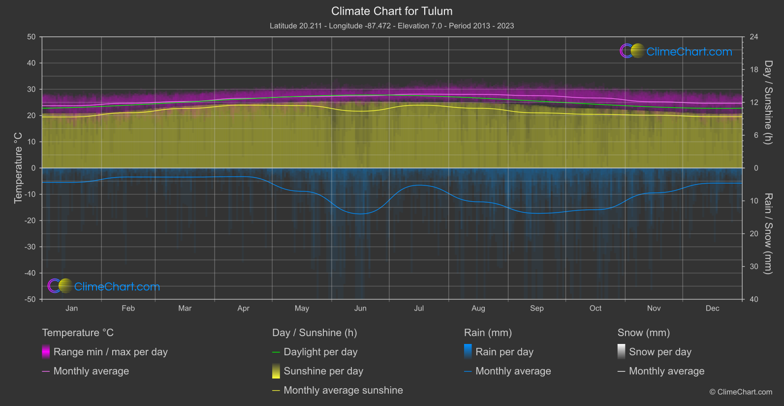
Tulum
Region South-East
The monthly mean temperature is lowest at 23.
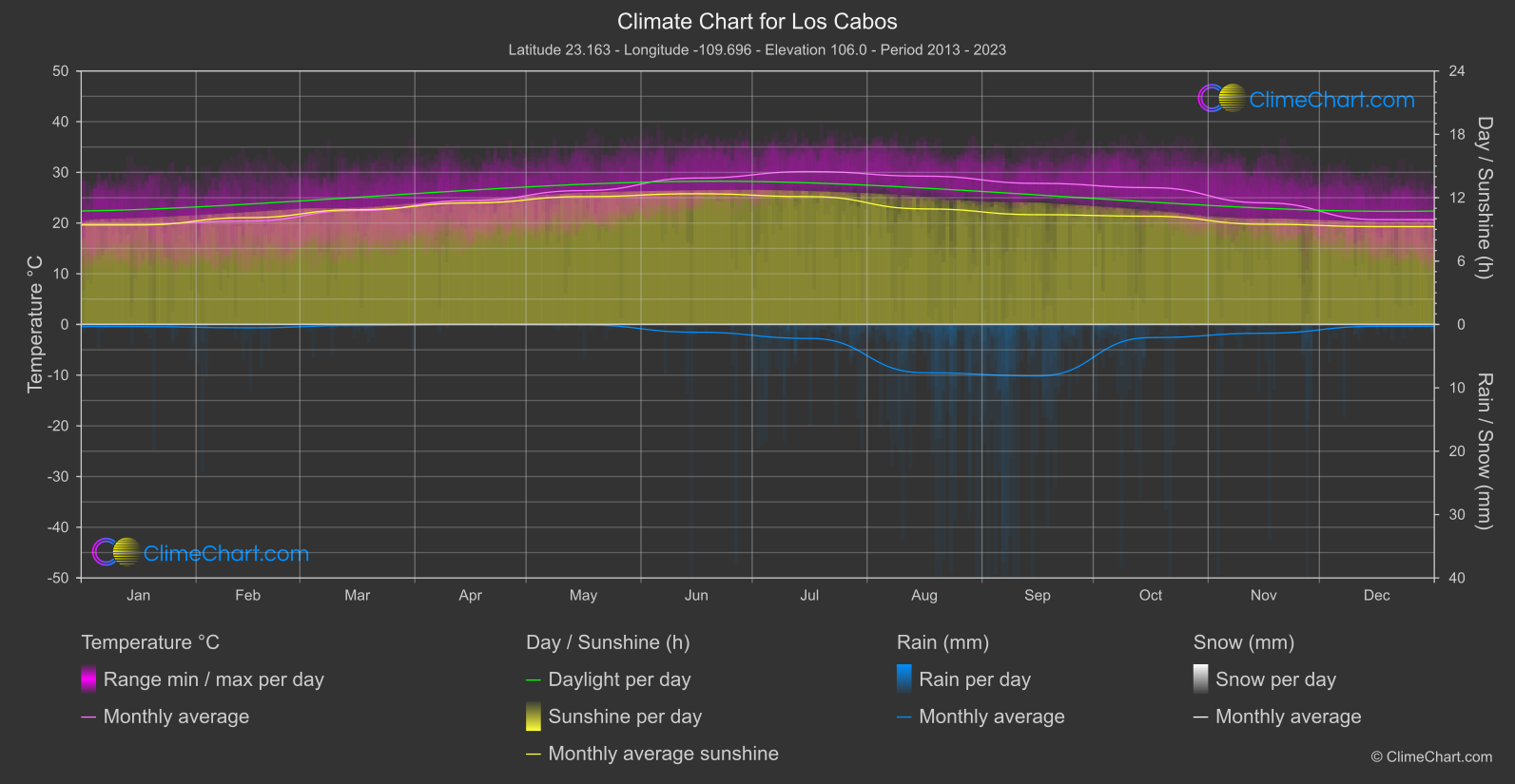
Los Cabos
Region West
Monthly mean temperatures reach their high point in July, at 30.
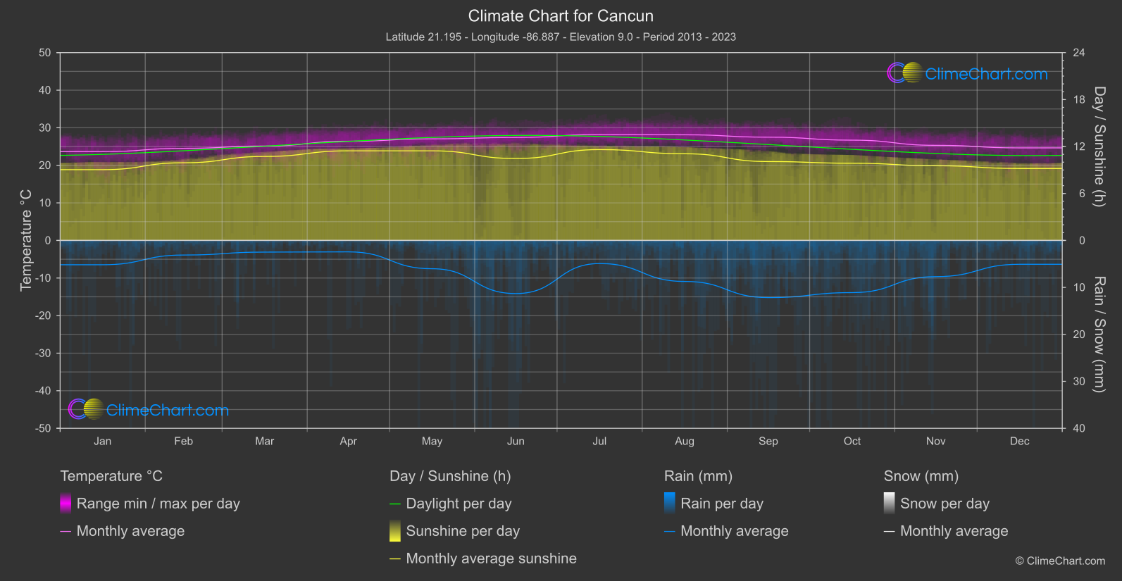
Cancun
Region East
Monthly mean temperatures reach their highest point in July, at 28.