Detailed Climate Information for Brazil: Regional Weather Patterns and Data
Welcome to Brazil, a country known for its diverse climate and stunning natural beauty.
Brazil experiences a range of climates due to its vast size and diverse geography. The northern part of the country near the equator has a tropical climate with high temperatures and humidity. Moving south, the climate transitions to a more temperate zone, with distinct seasons. The coastal areas enjoy a tropical climate, while the interior regions have a drier climate. The Amazon rainforest in the north experiences heavy rainfall throughout the year.
Best Travel Time Guide for Brazil: Ideal Seasons and Weather Insights
The best time to travel to Brazil varies depending on the region you plan to visit. For the coastal areas and cities like Rio de Janeiro and Salvador, the months from December to March offer warm temperatures and vibrant festivals. If you're heading to the Amazon rainforest, the dry season from June to September is ideal for exploring the lush jungle. The southern regions, such as Sao Paulo and Curitiba, have a more temperate climate and can be visited year-round.
Detailed Climate in the Regions of Brazil
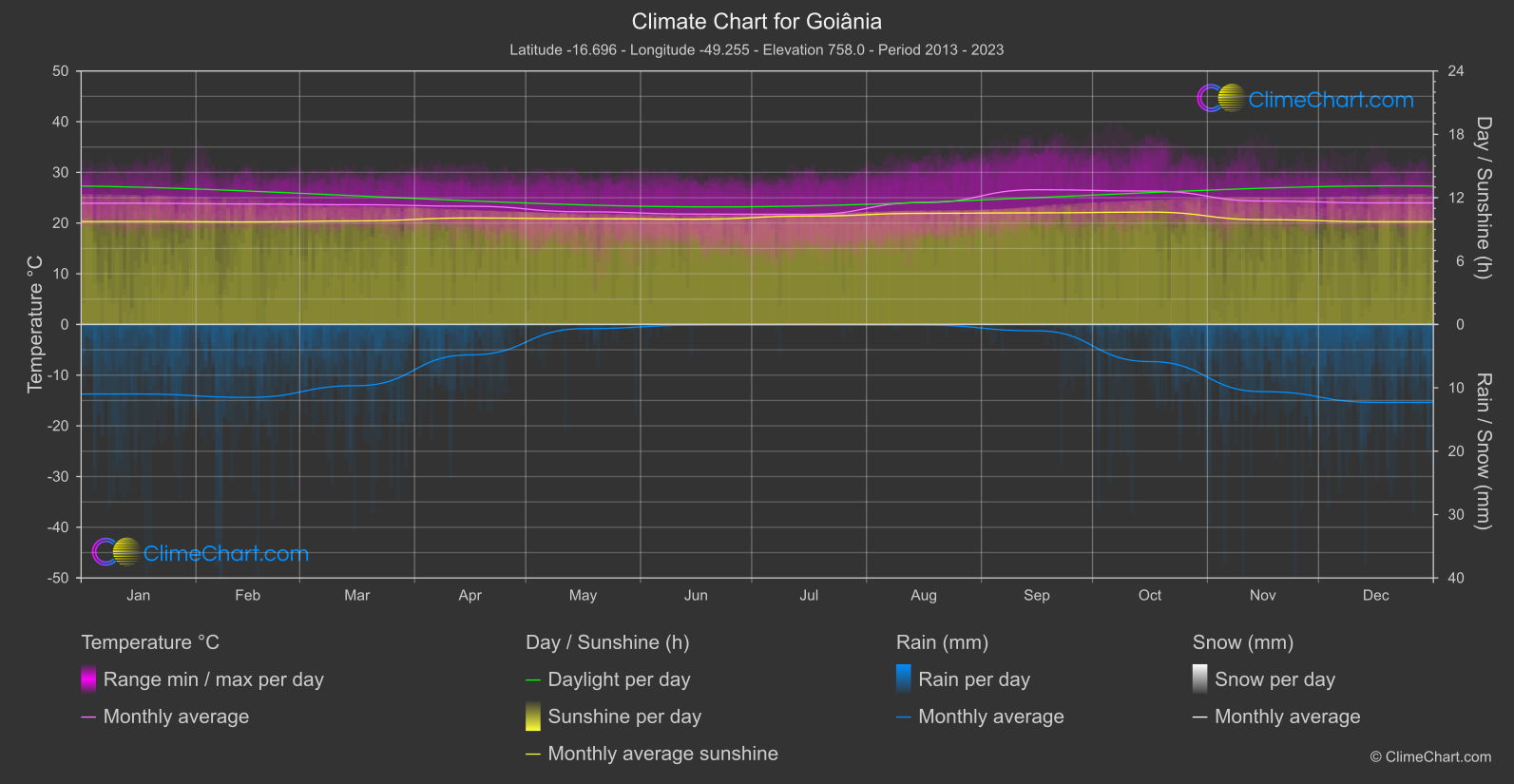
Goiânia
Region Central
The coolest monthly mean is recorded in July, at 21.
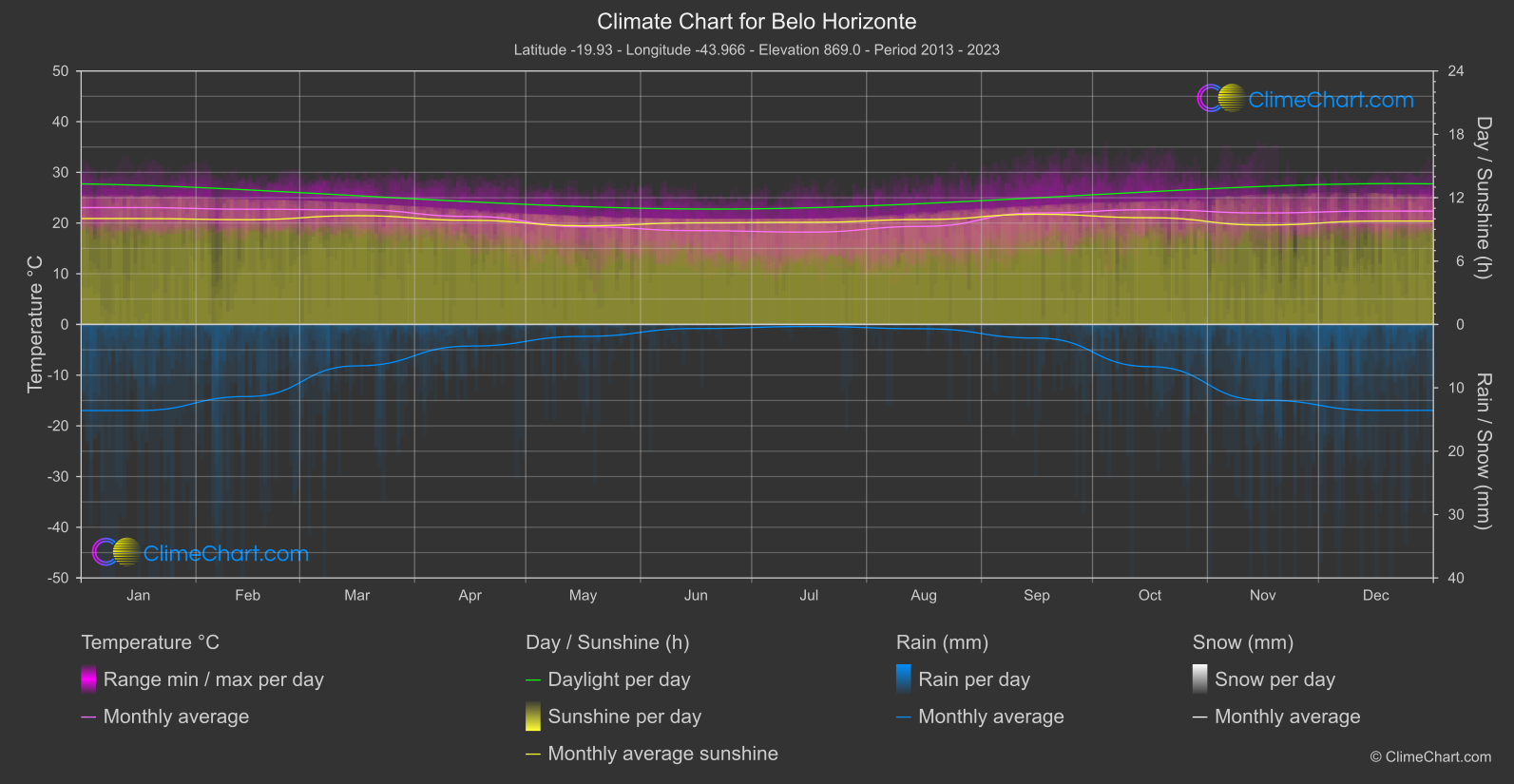
Belo Horizonte
Region East
Monthly mean temperatures are warmest in January, at 23.
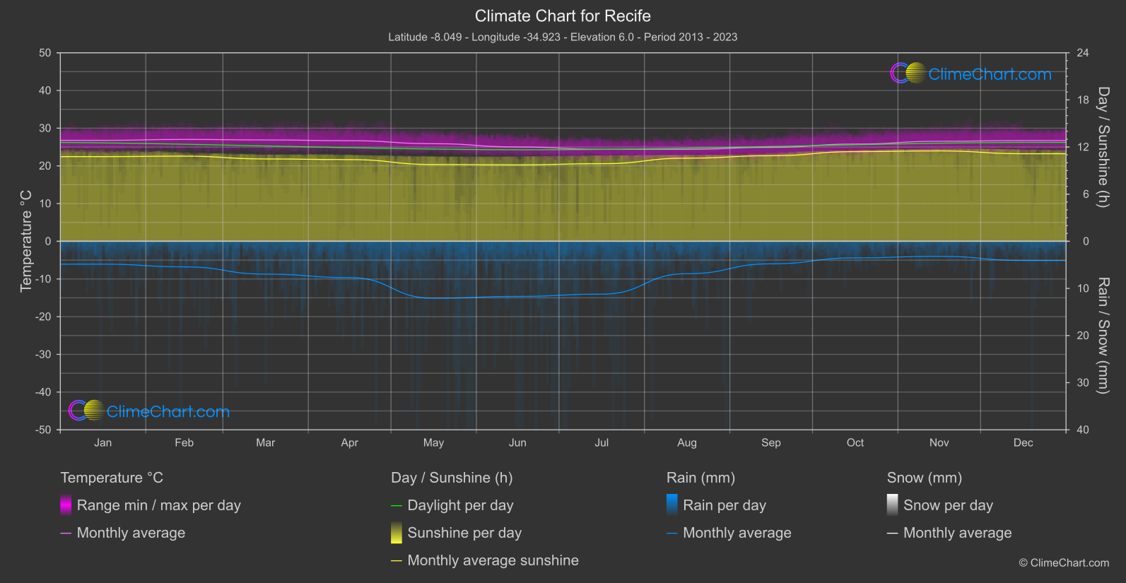
Recife
Region East
The monthly mean temperature reaches its high in February, at 27.
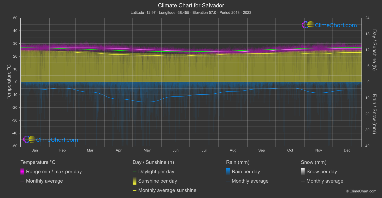
Salvador
Region East
The warmest monthly mean temperature occurs in February, at 26.
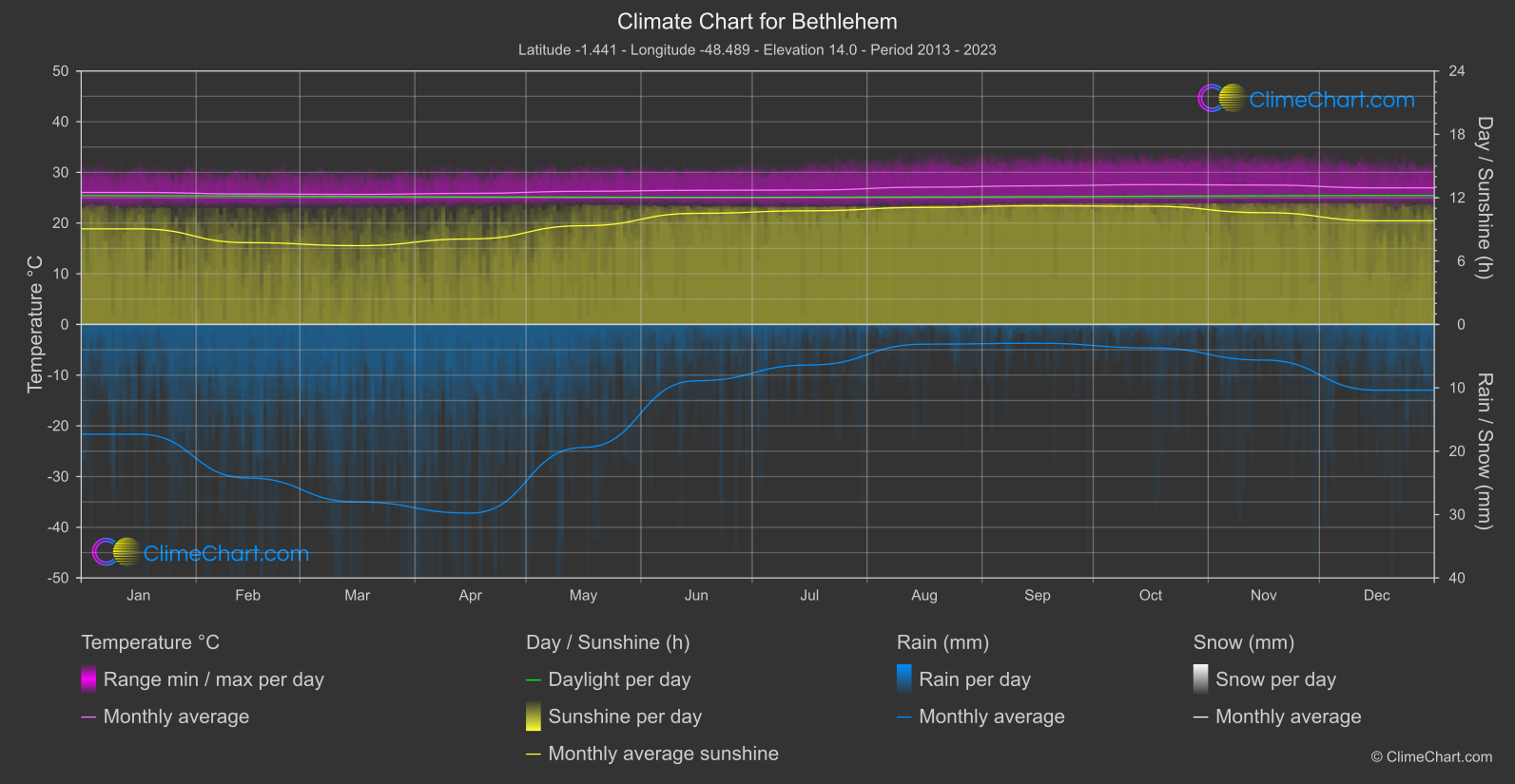
Bethlehem
Region North
The monthly mean temperature reaches its highest point in October, at 27.
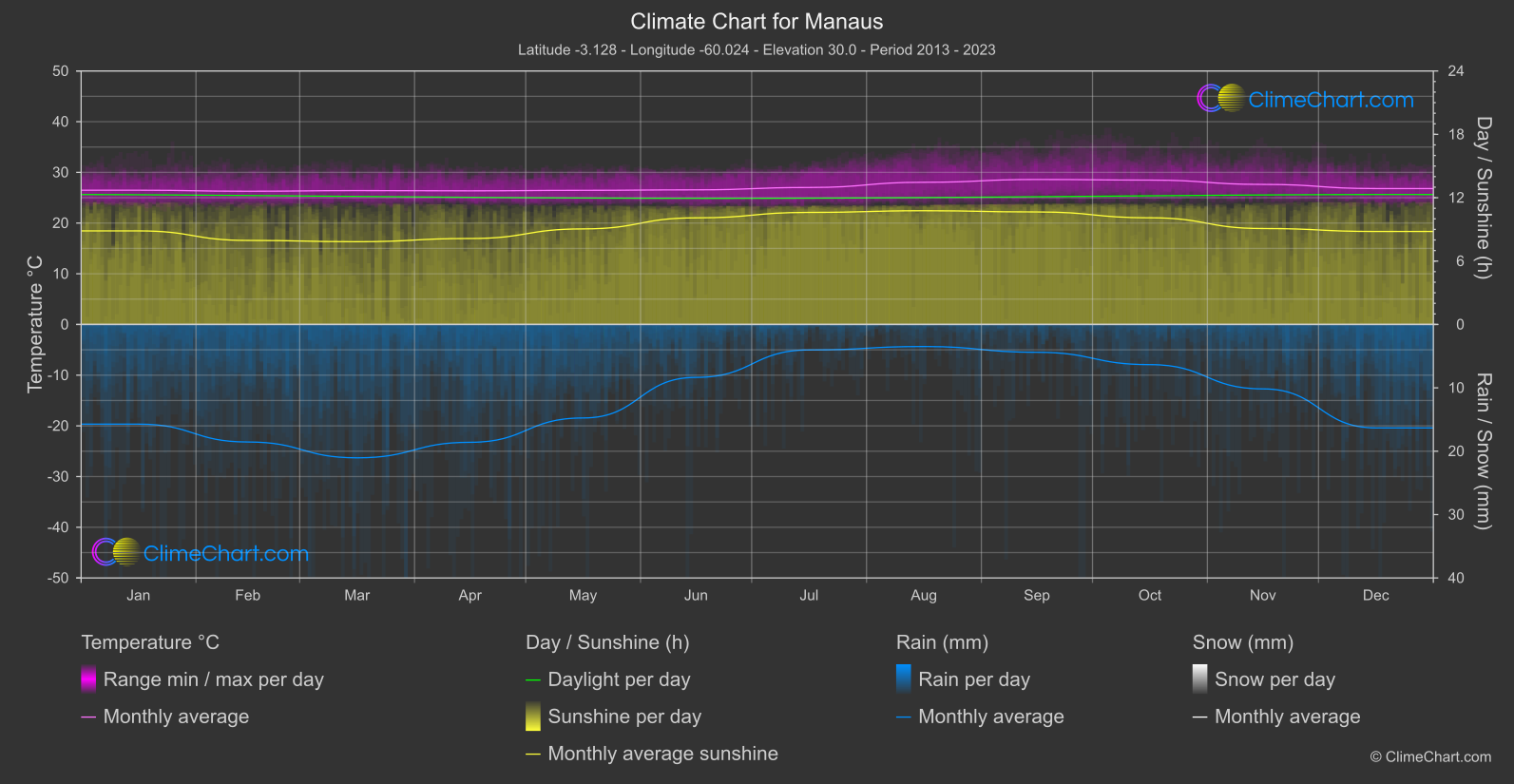
Manaus
Region North
Monthly mean temperatures range from 26.
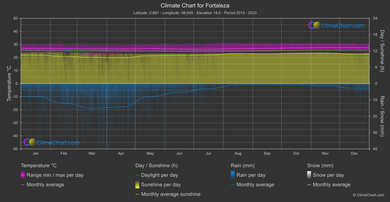
Fortaleza
Region North-East
The monthly mean temperature is highest in November / December and 27.
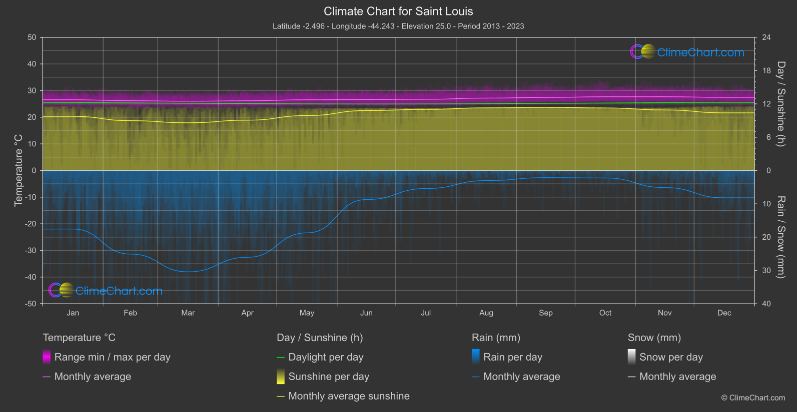
Saint Louis
Region North-East
Monthly mean temperatures range from March at 26.
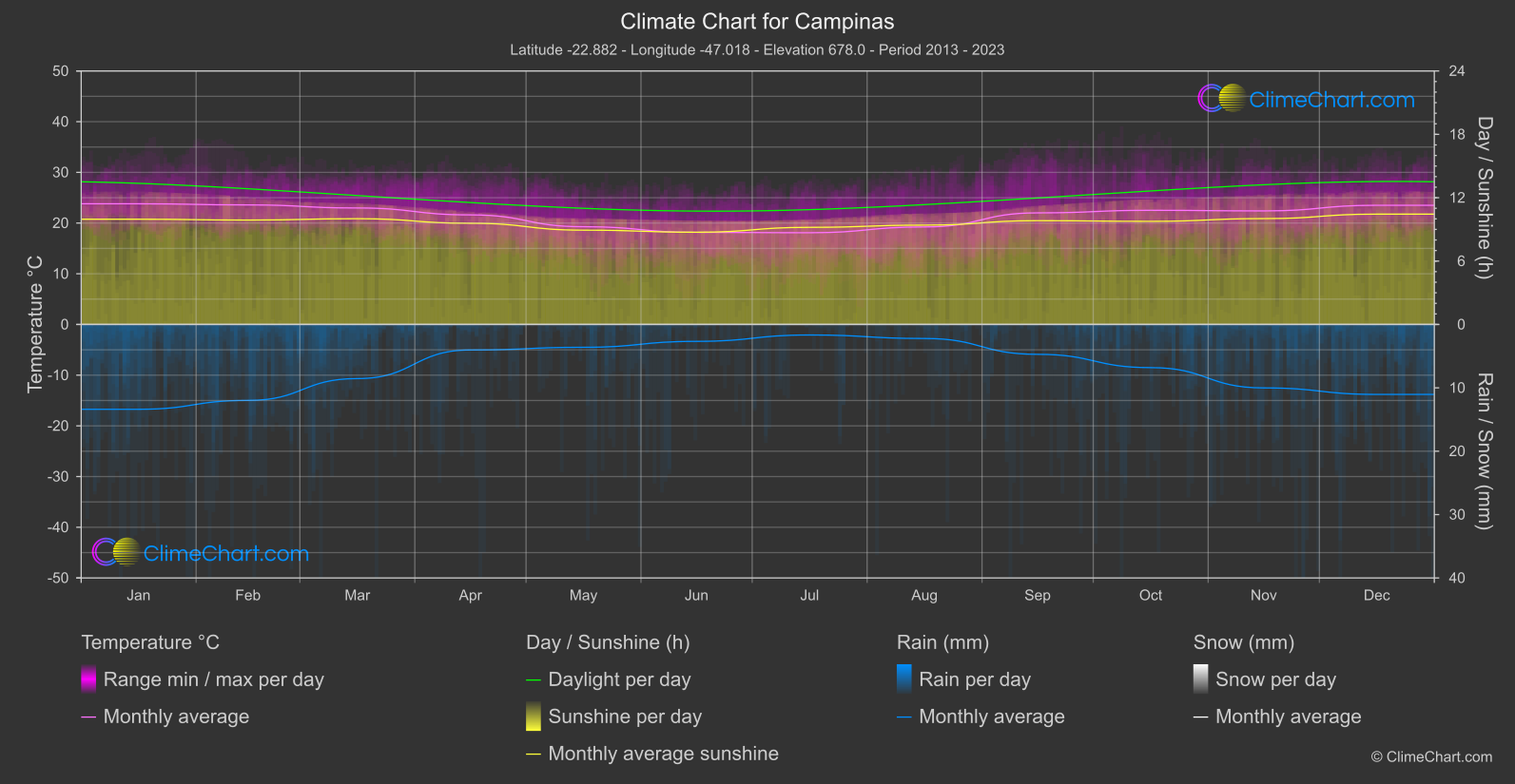
Campinas
Region South
The monthly mean temperature is highest in January, at 23.
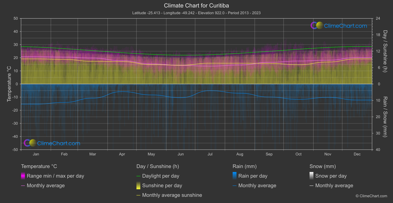
Curitiba
Region South
The monthly mean temperature reaches its highest value in January, at 20.
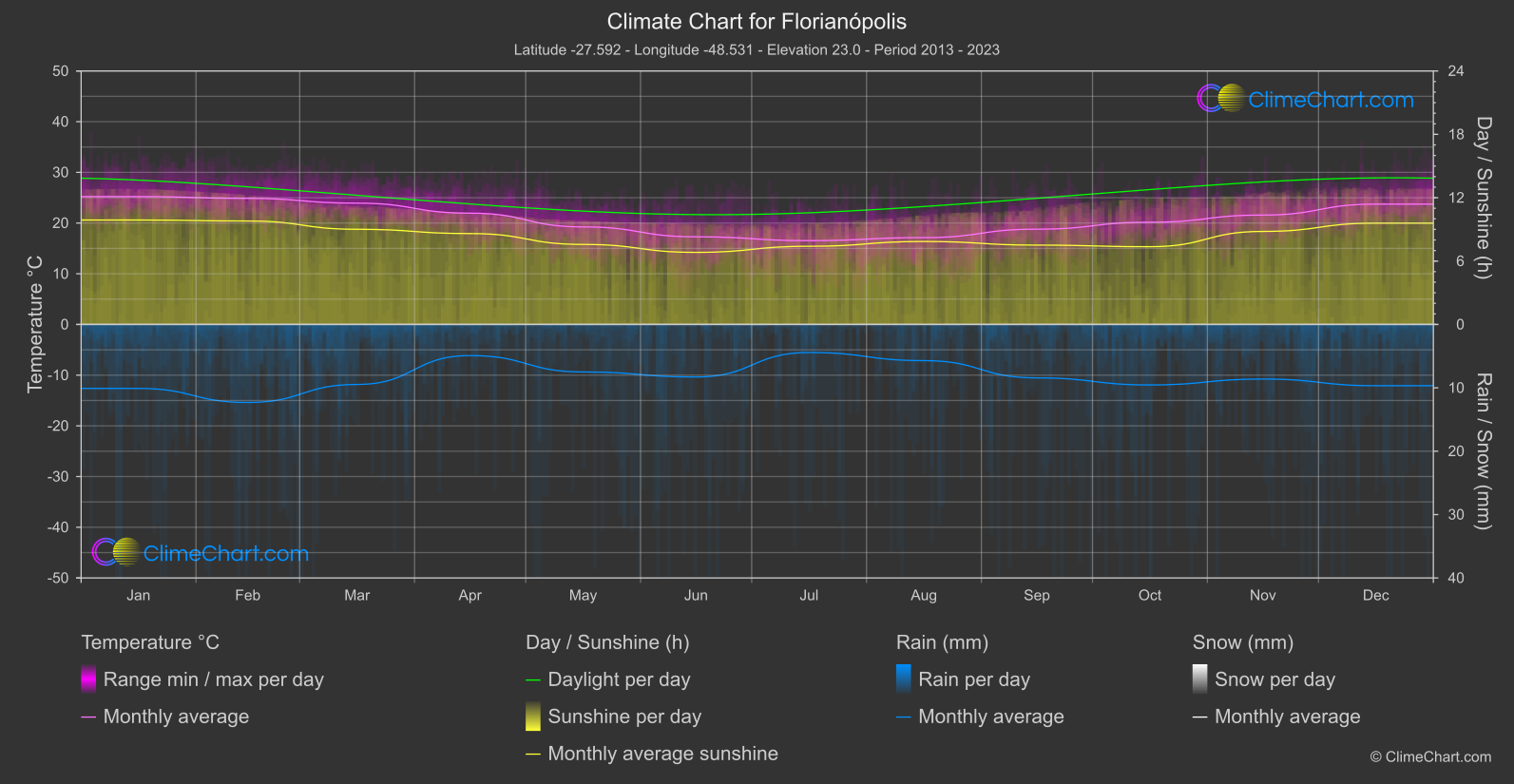
Florianópolis
Region South
The warmest monthly mean is recorded in January, at 25.
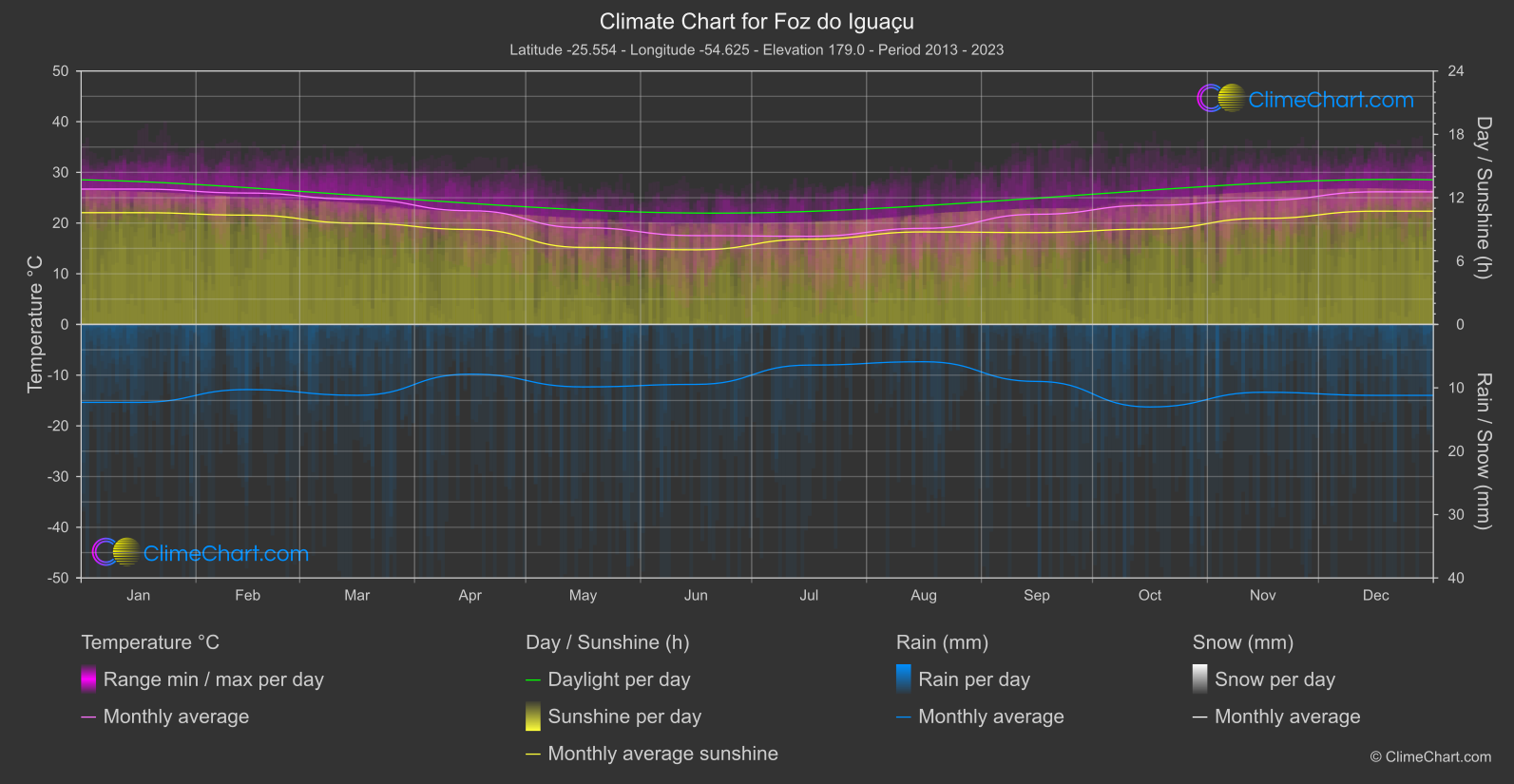
Foz do Iguaçu
Region South
The monthly mean temperature reaches its highest point in January at 26.
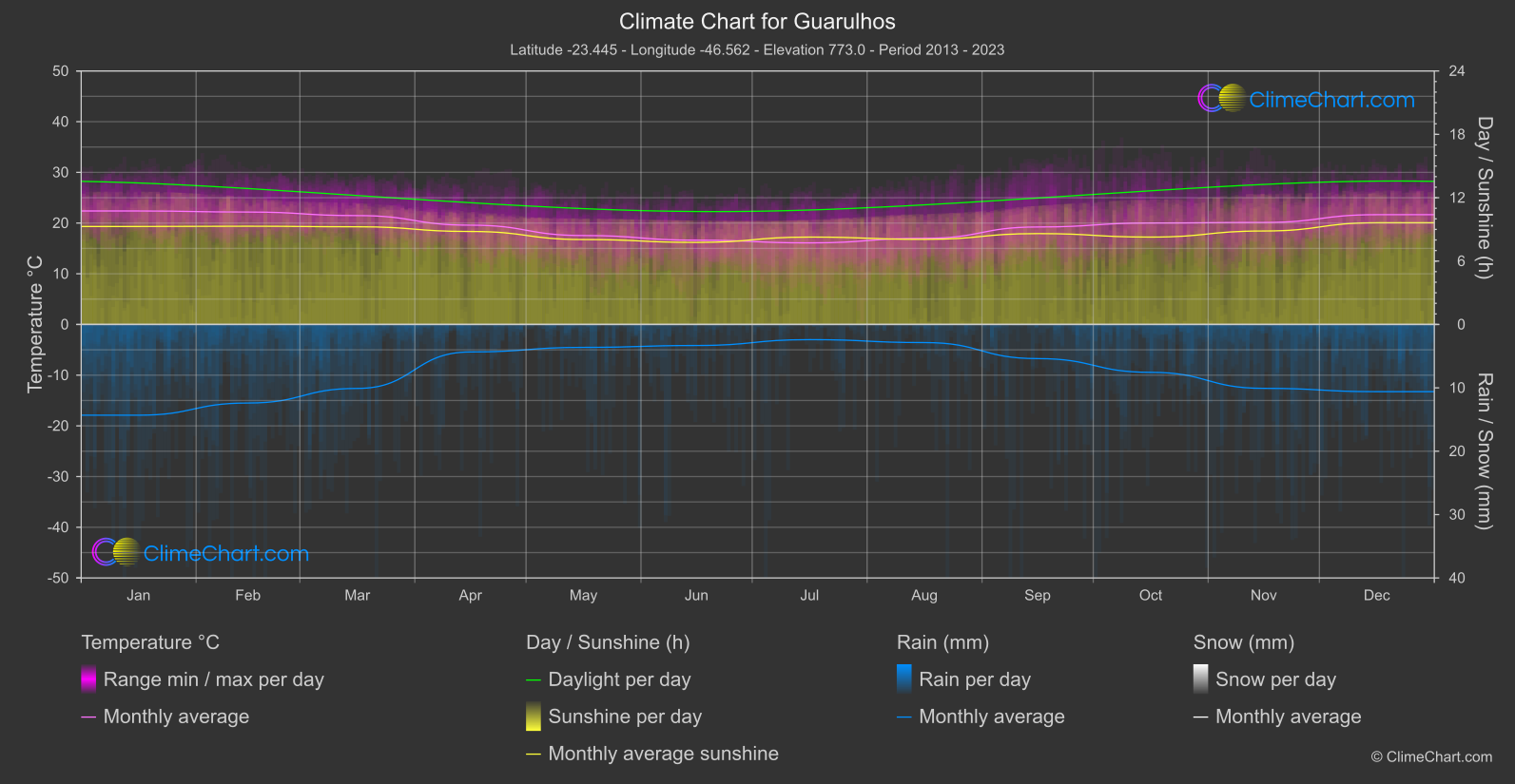
Guarulhos
Region South
Monthly mean temperatures range from the coolest reading, 16.
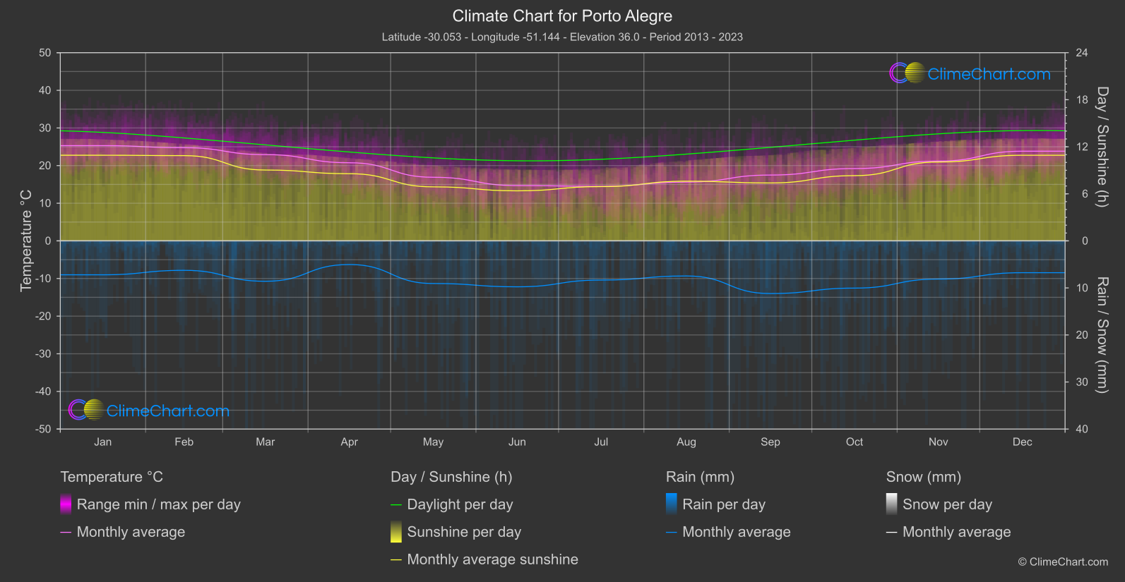
Porto Alegre
Region South
January has the highest monthly mean temperature, at 25.
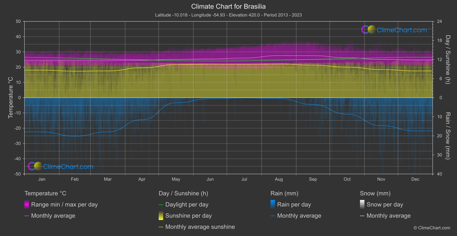
Brasilia
Region Central
Mean daily rainfall is lowest in July at 0.
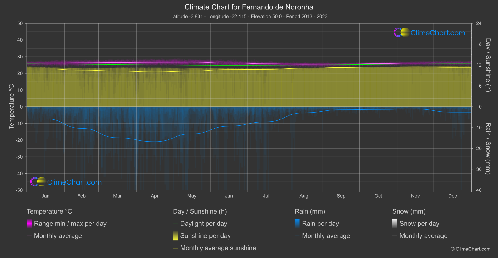
Fernando de Noronha
Region North-East
Monthly mean temperatures reach their highest level in April / May, at 26.
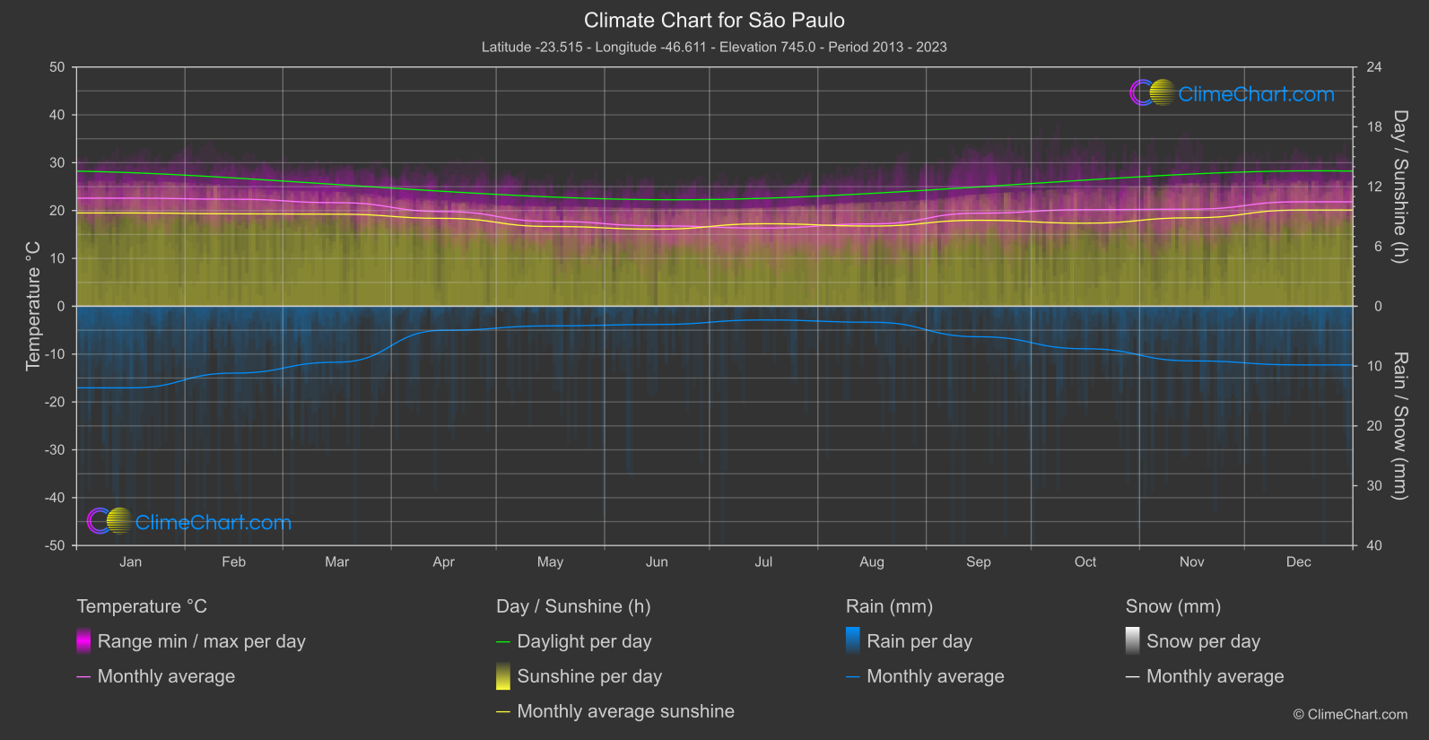
São Paulo
Region South
Monthly mean temperature reaches its highest point at 22.
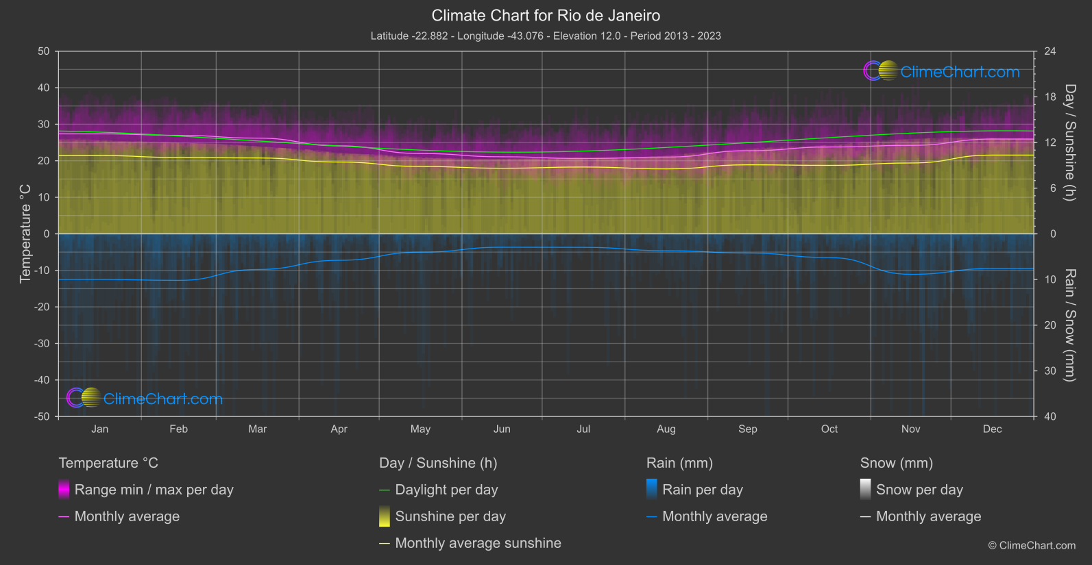
Rio de Janeiro
Region South-East
Monthly mean temperatures are highest in January, at 27.