Detailed Climate Information for Colombia: Regional Weather Patterns and Data
Colombia, located in South America, boasts a diverse climate that varies significantly across its regions.
Colombia features a tropical climate in the lowlands and along the coast, with cooler temperatures in the higher altitudes of the Andes mountains. The country experiences two main seasons, a dry season and a rainy season, with variations based on altitude and proximity to the equator.
Best Travel Time Guide for Colombia: Ideal Seasons and Weather Insights
The best time to travel to Colombia depends on the region you plan to visit. The dry season, from December to March and July to August, is ideal for coastal areas and cities like Cartagena. For the Andean regions, the best time is during the dry season to avoid heavy rainfall. The Amazon region experiences rain throughout the year, so visitors should be prepared for wet conditions.
Detailed Climate in the Regions of Colombia
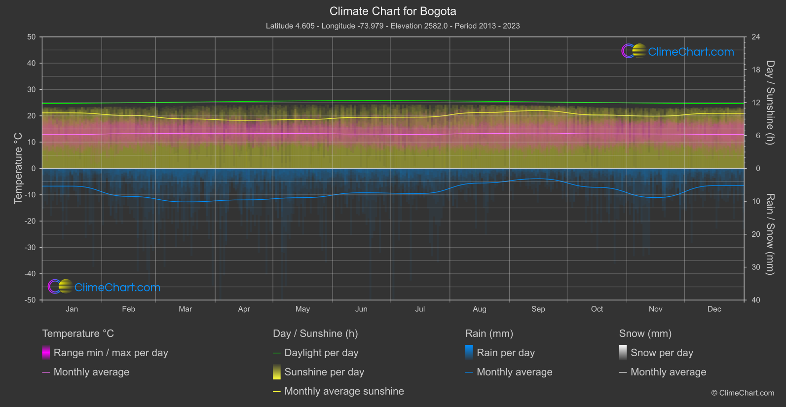
Bogota
Region Central
Monthly mean temperatures are notably close together: the lowest reading is shared by January / July / December at 12.
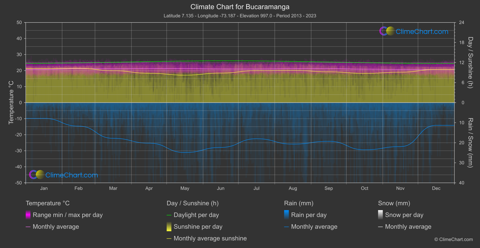
Bucaramanga
Region Central
Monthly mean temperature is relatively consistent in the supplied figures: the highest monthly mean occurs in April / May at 21.
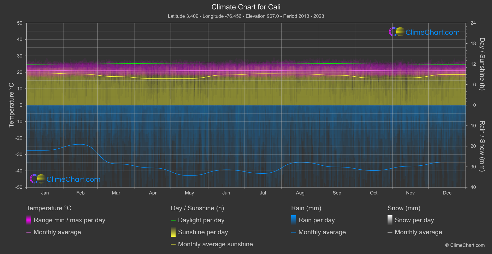
Cali
Region Central
Monthly mean temperatures vary little across the year: the highest monthly mean is tied between April / September at 21.
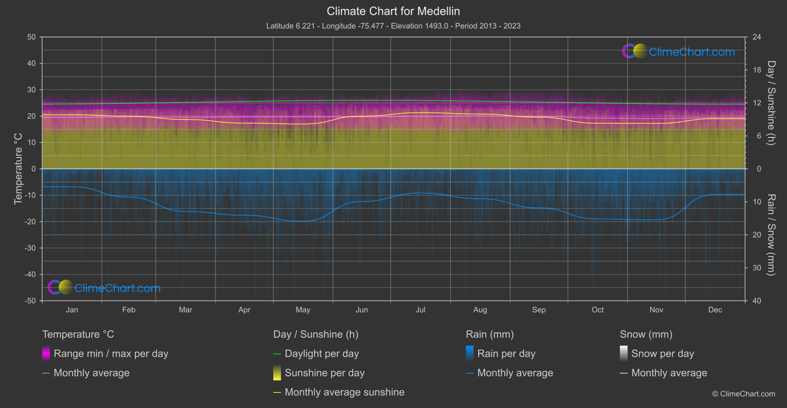
Medellin
Region Central
Monthly mean temperatures are tightly grouped: the highest is August at 20.
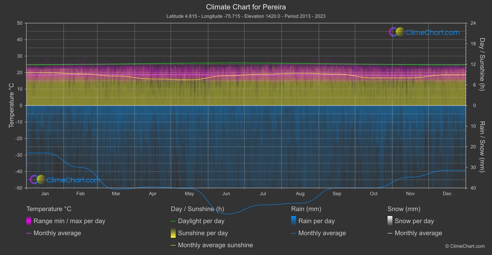
Pereira
Region Central
The monthly mean temperature reaches its high of 18.
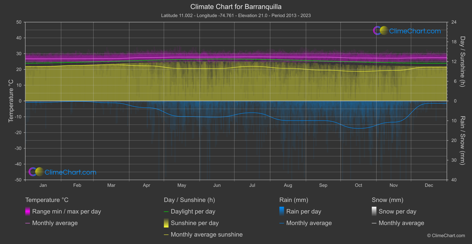
Barranquilla
Region North
Monthly mean temperatures range from January at 26.
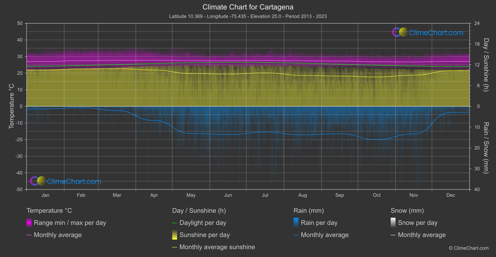
Cartagena
Region North
Monthly mean temperatures are comparatively steady in the figures provided, rather than indicating daytime highs.
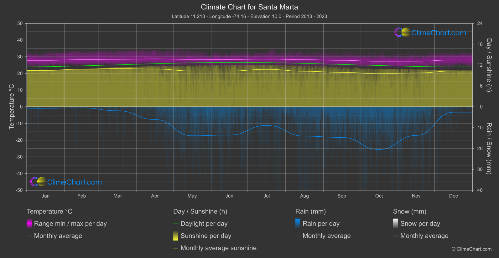
Santa Marta
Region North
The monthly mean temperature reaches its high of 28.
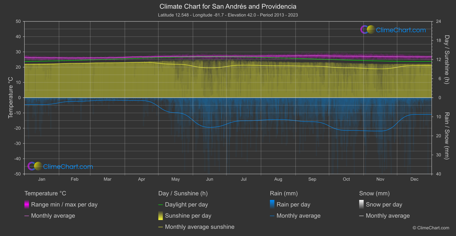
San Andrés and Providencia
Region North-West
Monthly mean temperatures range from February at 26.